|
Vegetation
Units of the Marmarica Plateau in NW-Egypt
(ca. 61km SSE of Mersa Matruh): |
| |
|
| |
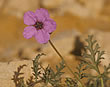
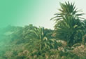
"Ring
Plaja vegetation" near A b u M
u k h a i y a t |
| |
|
| |
Adopted
from: Kehl, H., K.Stahr & J.Gauer (1984)
Soil-Vegetation relationship of a small Catchment
Area on the Libyan Plateau in N.W. Egypt.- Berliner
geowiss. Abh. (A) 50: 303-324 (5.figs), partly modified. |
| |
|
 |
Fig. 1:
Vegetation distribution map |
|
Tabl. 1:
Vegetation units and included species of the units
(incl. frequency and coverage values) |
|
Fig. 2:
Soil distribution map |
|
|
 |
|
| |
|
- Distribution
map of the ring-shaped plaja vegetation near
Abu Mukhaiyat, central Marmarica Plateau, with
zonal arrangement of vegetation units (ca.
61km SSE of Mersa Matruh; map with idealised
contour lines, for location and co-ordinates
compare fig. 1, according to Bornkamm
& Kehl, 1989, the area under research
is located between the 'full desert' and 'extreme
desert I', cf. "Ökologische
Wüstentypen").
|
| |
|
 |
|
|
|
 Abb.
D2-02/01 (above): Abb.
D2-02/01 (above):
Distribution of Plant Communities. |
|
|
|
|
| |
|
| |
 Tab.
D2-02/01: Tab.
D2-02/01:
Zonal arrangement of vegetation units, and species
forming the units of the plaja near Abu Mukhaiyat,
center of the Marmarica Plateau, ca. 61km S of the
coast near Mersa Matruh. Frequency and coverage
according to Braun-Blanquet. |
| |
|
 |
|
|
|
 |
| |
|
| |
|
 |
| |
|
| |
Abb.
/ Fig. D2-02/02:
Plaja soil distribution map of a small depression
near Abu Mukhaiyat, central Marmarica Plateau, partly
with zonal arrangement of soil units (ca. 61km SSE
of Mersa Matruh; map with idealised contour lines,
soils developed from miocene limestone of the marmarican
formation). |
| |
|
| |
Abb.
/ Fig. and Tabl. from:
Kehl, H., K.Stahr & J.Gauer (1984) Soil-Vegetation
relationship of a small Catchment Area on the Libyan
Plateau in N.W. Egypt.- Berliner geowiss. Abh.
(A) 50: 303-324 (5.figs), partly modified for the
internet publication by H.Kehl, 2006. |
| |
|
|
|
 |